Hi all! Sorry for not posting for so long!
We are currently on the south coast of Australia in Adelaide getting ready to head north into the desert. More on that later :)
Since we're so far behind on the blog I'll probably start posting our current Australia activities as well as continuing to catch up on New Zealand. Hopefully it won't be too confusing. Also I just posted a lengthy (probably too lengthy) account of our last major tramp in NZ. Let us know what you think :)
Cheers,
Christina & Justin
Monday, September 29, 2008
Tramping the Abel Tasman Coastal Track (4 days)
16Jul08
After a short night's sleep we got up very early, raced around the hostel to check out, and headed towards Marahau to catch the watertaxi to our start on the Abel Tasman coastal tramp. The drive to Marahau in the early dawn light turned out to be absolutely stunning – the rosy light reflecting off the still water. We were frustrated that we didn't have time to stop and enjoy it (or photograph it)!
Once in Marahau we checked in for the water taxi and were quickly on our way. The watertaxi is essentially a water-borne bus shuttling hikers to and from the various beaches up the coast in the Abel Tasman National Park as most of the park is inaccessible by roads.
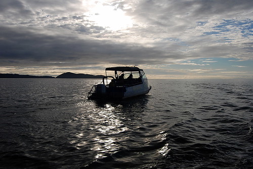
We were going to one of the northern most beach on the taxi route, Totaranui, and so we had about an hour to hour-and-a-half ride. The boat ride turned out to be really fun – much more than just necessary transport. We got to see all the bays and coves along the coast, and the driver took us to a seal colony at a nearby island (with many pups) and into the Awaroa estuary since it was high tide. In the estuary we spotted several large manta rays gliding about – apparently they come into the fresh water to help get rid of parasites. Believe it or not, this large estuary is dry enough to walk across at low tide, and we'd be doing just that on our second day.
By the time we alighted on beautiful Totaranui beach it was time for lunch, but we settled for peanut-butter and jelly sandwiches – haha. The sandflies were murderous - we ate in a cloud of flies with several fantail birds zipping around and even landing on us to catch them. The fantails are a tramper's best friend :)
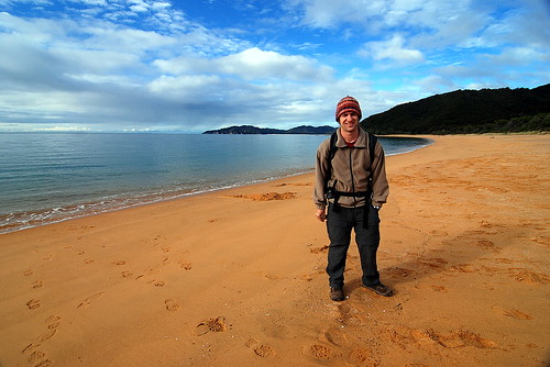
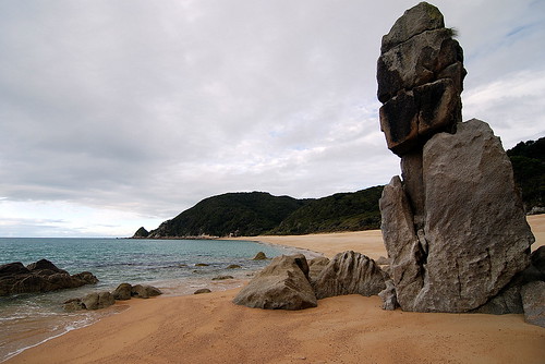
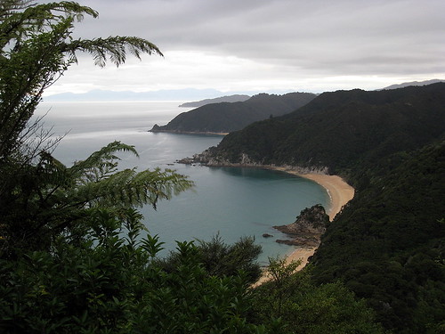
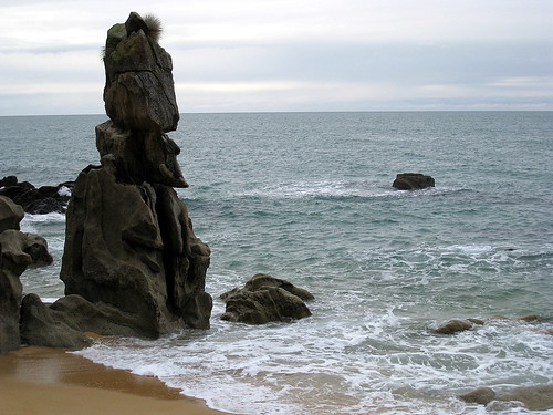
Totaranui beach has a huge campground that is supposedly brimming with hundreds of tourists in the summer – we had it all to ourselves. After lunch we headed north to our destination for the night, Whariwharangi Hut (try saying that three times in a row). The trail took us across the stream at Totaranui beach, then up the headland for some great views. Then back down to secluded Anapai beach with some large stone outcrops that looked like Easter Island heads.
Then up and over another headland to Mutton Cove beach, and since it was by now low tide we could take the tidal route along the beach and up another headland to Separation Point and the seal colony. And finally we headed west and descended to Whariwarangi Bay and the hut during dusk. On the descent we were lucky enough to spot a native NZ owl, the Morepork. Hoot hoot!
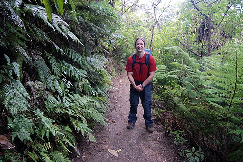
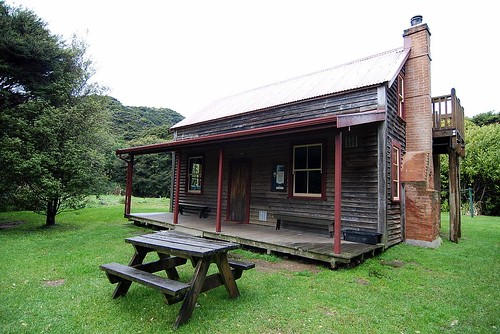
The Whariwarangi hut is a charming historic homestead house that DOC now manages. We foolishly didn't realize we needed to bring candles, but fortunately there were enough candle stubs for us to get by. We had flashlights, but candles are so much better at lighting up the room.
At first we thought we'd have the hut to ourselves, but sometime after dark two german guys showed up. Unlike most of the germans we've met on this trip, they weren't very friendly and just spent the evening talking in german and ignoring us. Oh well – at least they helped us light the cranky wood stove for some heat.
17Jul08
It rained during the night and in the morning, but fortunately stopped before we left the hut. Today we headed south 13km to Akaroa hut and had to hurry to catch the low tide crossing of Akaroa Estuary around 2pm. We started by backtracking to Totaranui beach, partly on the same paths and partly on alternative ones for a change of scenery.
I don't mind backtracking on a trails like this anyways – there is plenty to see and the beaches all look different at high versus low tide. South of Totaranui the trail led us along the beaches of Goat Bay
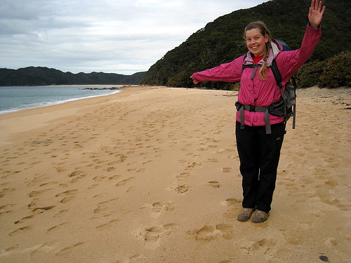
and Waiharakeke Bay, and then inland around a headland to arrive at the northern edge of the large Akaroa estuary. Even though we were running a little behind schedule we were luckily still close enough to low tide to easily cross the tidal flat. The estuary has to be nearly a kilometer across and full of shell fish that crunched under foot. We switched to chacos to spare our boots, but “real jokers” just walk across it with no hesitation!
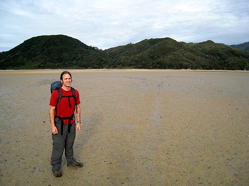
Akaroa hut is just on the southern edge of the estuary, and so we had an early finish for the day. A group of three guys were at the hut when we arrived, but they decided to press on to the next hut so we lucked out and had the whole place to ourselves. And before they left they gave us some candles :)
Before dark, we walked out towards the ocean to watch the tide come in to the estuary – and it comes in very quickly. There is a little settlement of homes nearby and a tourist lodge.
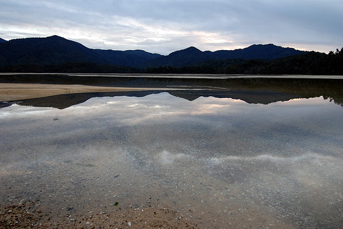
Akaroa hut is very nice with great views and a central stove that heated up the whole place making for a cosy evening.
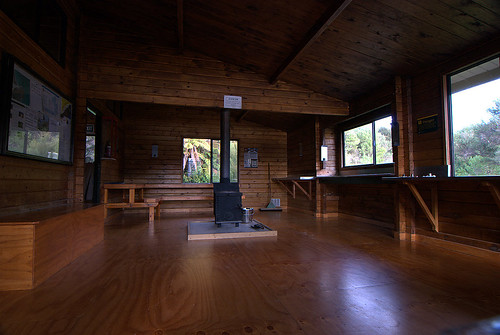
18Jul08
Today we hiked 21km south to Anchorage hut. We intentionally got off to a slow start in order to arrive at the Onetahuti tidal crossing at lowish tide. We started by hiking inland for awhile and our hopes of stopping at the lodge cafe for a coffee were dashed by the high tide! Oh well, we didn't *really* need it!
We arrived at Onetahuti stream to find that we didn't need to worry about crossing it as it's fairly small. We stopped for lunch on the beach here and contemplated taking some unguarded kayaks for a spin, but good manners got the better of us and we trudged ahead on foot instead.
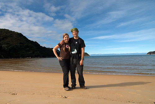
Next up was Bark Bay which has an inland “all-tides” track, but since it was low-tide I wanted to take the shorter low-tide beach track... which turned out to be a mistake. We had to wade across a stream that was mid-thigh deep and had a quicksand-like bottom – we sunk up to our ankles – and then across a very mucky estuary plain. So much for the shortcut! Eventually we were back on the main trail headed to Anchorage Hut, but the largest estuary yet was still between us and the hut and we were running out of time due to the slow down at Bark Bay.
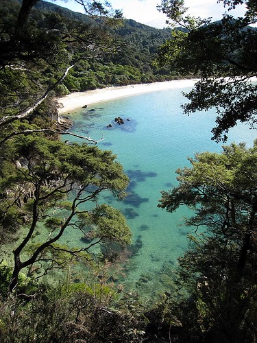
When we reached the estuary we were past low-tide, but since the high-tide track took an extra hour and would guarantee us to be hiking past sunset, we decided to push our luck and walk across the estuary hoping not to get flooded by the tide coming back in. This estuary was very large and mucky with lots of little stream rivulets to navigate around, but we made good time and reached the other side before dark and without getting too wet :)
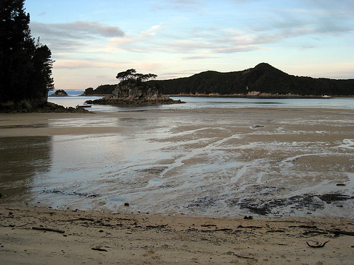
Then it was a quick jaunt up and over a headland to the hut which is located on beautiful Anchorage Bay. Over water-taxi driver told us that around New Year's Eve the bay is bumper to bumper with “boaties” as it's a great holiday spot. It was hard for us to imagine as we walked along the beach watching a fantastic full moon rise.
The hut was nice enough, but unfortunately we had company. A group of six guys had kayaked in with a truckload of booze and food and proceeded to have a loud party (including singing) til late in the night. We were a little irked, to say the least, and jealous of their feast as we nibbled on powdered hummus and stale digestive biscuits! By this the third night we were really running out of food and had to budget ourselves for the next day.
19Jul08
Woke up this morning to a torrential downpour. Ugh, we still had about 10 km back to our van in Marahau. The party-guys were a little more subdued in daylight, although the Trent Reznor lookalike was coughing and hacking so badly I was worried we catch the plague! To be fair, they were nice enough and tempted us to catch the water-taxi home because of the rain, but instead we put on all our raingear and trudged off for the trail figuring it might let up.
One benefit of the heavy rain is that every little tricky becomes a gushing waterfall. The hike back to Marahau was wet but very pretty and the rain did let up eventually.
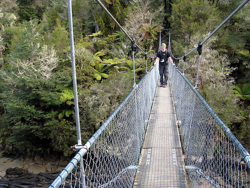
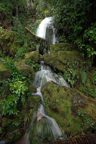
By the time we got back to the van we were starving for lunch but all the cafes were closed in Marahau so we had to drive all the way back to Motueka for a big greasy fish and chips, yum :)
Afterwards we headed north to Takaka via spectacular Takaka Hill. We came over the crest and could suddenly see snow-capped mountains and a beautiful green valley below. We checked into a hostel called Annie's Nirvana, which turned out to be kinda down at the heels, but it did have the all important hot showers!
All in all we really enjoyed the Abel Tasman Coastal Track - it was one of the areas we daydreamed about visiting before we started our trip and it was every bit as beautiful as we'd hoped. It's hard to beat palm trees, tree ferns and spectacular beaches.
day 1 photoset
day 2 photoset
day 3-4 photoset
After a short night's sleep we got up very early, raced around the hostel to check out, and headed towards Marahau to catch the watertaxi to our start on the Abel Tasman coastal tramp. The drive to Marahau in the early dawn light turned out to be absolutely stunning – the rosy light reflecting off the still water. We were frustrated that we didn't have time to stop and enjoy it (or photograph it)!
Once in Marahau we checked in for the water taxi and were quickly on our way. The watertaxi is essentially a water-borne bus shuttling hikers to and from the various beaches up the coast in the Abel Tasman National Park as most of the park is inaccessible by roads.

We were going to one of the northern most beach on the taxi route, Totaranui, and so we had about an hour to hour-and-a-half ride. The boat ride turned out to be really fun – much more than just necessary transport. We got to see all the bays and coves along the coast, and the driver took us to a seal colony at a nearby island (with many pups) and into the Awaroa estuary since it was high tide. In the estuary we spotted several large manta rays gliding about – apparently they come into the fresh water to help get rid of parasites. Believe it or not, this large estuary is dry enough to walk across at low tide, and we'd be doing just that on our second day.
By the time we alighted on beautiful Totaranui beach it was time for lunch, but we settled for peanut-butter and jelly sandwiches – haha. The sandflies were murderous - we ate in a cloud of flies with several fantail birds zipping around and even landing on us to catch them. The fantails are a tramper's best friend :)

Totaranui beach has a huge campground that is supposedly brimming with hundreds of tourists in the summer – we had it all to ourselves. After lunch we headed north to our destination for the night, Whariwharangi Hut (try saying that three times in a row). The trail took us across the stream at Totaranui beach, then up the headland for some great views. Then back down to secluded Anapai beach with some large stone outcrops that looked like Easter Island heads.

Then up and over another headland to Mutton Cove beach, and since it was by now low tide we could take the tidal route along the beach and up another headland to Separation Point and the seal colony. And finally we headed west and descended to Whariwarangi Bay and the hut during dusk. On the descent we were lucky enough to spot a native NZ owl, the Morepork. Hoot hoot!


The Whariwarangi hut is a charming historic homestead house that DOC now manages. We foolishly didn't realize we needed to bring candles, but fortunately there were enough candle stubs for us to get by. We had flashlights, but candles are so much better at lighting up the room.

At first we thought we'd have the hut to ourselves, but sometime after dark two german guys showed up. Unlike most of the germans we've met on this trip, they weren't very friendly and just spent the evening talking in german and ignoring us. Oh well – at least they helped us light the cranky wood stove for some heat.
17Jul08
It rained during the night and in the morning, but fortunately stopped before we left the hut. Today we headed south 13km to Akaroa hut and had to hurry to catch the low tide crossing of Akaroa Estuary around 2pm. We started by backtracking to Totaranui beach, partly on the same paths and partly on alternative ones for a change of scenery.

I don't mind backtracking on a trails like this anyways – there is plenty to see and the beaches all look different at high versus low tide. South of Totaranui the trail led us along the beaches of Goat Bay

and Waiharakeke Bay, and then inland around a headland to arrive at the northern edge of the large Akaroa estuary. Even though we were running a little behind schedule we were luckily still close enough to low tide to easily cross the tidal flat. The estuary has to be nearly a kilometer across and full of shell fish that crunched under foot. We switched to chacos to spare our boots, but “real jokers” just walk across it with no hesitation!

Akaroa hut is just on the southern edge of the estuary, and so we had an early finish for the day. A group of three guys were at the hut when we arrived, but they decided to press on to the next hut so we lucked out and had the whole place to ourselves. And before they left they gave us some candles :)
Before dark, we walked out towards the ocean to watch the tide come in to the estuary – and it comes in very quickly. There is a little settlement of homes nearby and a tourist lodge.

Akaroa hut is very nice with great views and a central stove that heated up the whole place making for a cosy evening.

18Jul08
Today we hiked 21km south to Anchorage hut. We intentionally got off to a slow start in order to arrive at the Onetahuti tidal crossing at lowish tide. We started by hiking inland for awhile and our hopes of stopping at the lodge cafe for a coffee were dashed by the high tide! Oh well, we didn't *really* need it!
We arrived at Onetahuti stream to find that we didn't need to worry about crossing it as it's fairly small. We stopped for lunch on the beach here and contemplated taking some unguarded kayaks for a spin, but good manners got the better of us and we trudged ahead on foot instead.

Next up was Bark Bay which has an inland “all-tides” track, but since it was low-tide I wanted to take the shorter low-tide beach track... which turned out to be a mistake. We had to wade across a stream that was mid-thigh deep and had a quicksand-like bottom – we sunk up to our ankles – and then across a very mucky estuary plain. So much for the shortcut! Eventually we were back on the main trail headed to Anchorage Hut, but the largest estuary yet was still between us and the hut and we were running out of time due to the slow down at Bark Bay.

When we reached the estuary we were past low-tide, but since the high-tide track took an extra hour and would guarantee us to be hiking past sunset, we decided to push our luck and walk across the estuary hoping not to get flooded by the tide coming back in. This estuary was very large and mucky with lots of little stream rivulets to navigate around, but we made good time and reached the other side before dark and without getting too wet :)

Then it was a quick jaunt up and over a headland to the hut which is located on beautiful Anchorage Bay. Over water-taxi driver told us that around New Year's Eve the bay is bumper to bumper with “boaties” as it's a great holiday spot. It was hard for us to imagine as we walked along the beach watching a fantastic full moon rise.
The hut was nice enough, but unfortunately we had company. A group of six guys had kayaked in with a truckload of booze and food and proceeded to have a loud party (including singing) til late in the night. We were a little irked, to say the least, and jealous of their feast as we nibbled on powdered hummus and stale digestive biscuits! By this the third night we were really running out of food and had to budget ourselves for the next day.
19Jul08
Woke up this morning to a torrential downpour. Ugh, we still had about 10 km back to our van in Marahau. The party-guys were a little more subdued in daylight, although the Trent Reznor lookalike was coughing and hacking so badly I was worried we catch the plague! To be fair, they were nice enough and tempted us to catch the water-taxi home because of the rain, but instead we put on all our raingear and trudged off for the trail figuring it might let up.
One benefit of the heavy rain is that every little tricky becomes a gushing waterfall. The hike back to Marahau was wet but very pretty and the rain did let up eventually.


By the time we got back to the van we were starving for lunch but all the cafes were closed in Marahau so we had to drive all the way back to Motueka for a big greasy fish and chips, yum :)
Afterwards we headed north to Takaka via spectacular Takaka Hill. We came over the crest and could suddenly see snow-capped mountains and a beautiful green valley below. We checked into a hostel called Annie's Nirvana, which turned out to be kinda down at the heels, but it did have the all important hot showers!
All in all we really enjoyed the Abel Tasman Coastal Track - it was one of the areas we daydreamed about visiting before we started our trip and it was every bit as beautiful as we'd hoped. It's hard to beat palm trees, tree ferns and spectacular beaches.
day 1 photoset
day 2 photoset
day 3-4 photoset
Subscribe to:
Comments (Atom)
