Saturday, October 25, 2008

Palm Trees and Art Lessons

Palm Valley, Hermannsburg and on to Alice Springs
16Oct08

In the morning I was very excited to see a pair of Major Mitchell Cockatoos! I've been looking for these for awhile since reading about them in my bird book. They are spectacular birds with white bodies, pink under the wings and a very showy crest that has red and yellow stripes. Have I mentioned how much I love parrots yet?? The camp had lots of birds including butcherbirds and our old friend, "santa crow" who goes "ho-ho-ho" in a strange strangled voice.

The actual Palm Valley trailhead was a few kms up the road, but the "road" was a very rough 4wd track down a dry riverbed. I thought it was great fun - but I wasn't driving! Several times we had to stop and investigate on foot to find the best path over the rocks. The Landcruiser is a lot tougher than we give her credit :)


The drive was worth every rattle - Palm Valley is an amazing oasis of prehistoric palm trees in a lovely sandstone gorge. We took a 5km loop walk that takes you through the dry scrub and spinifex on the ridge above the gorge before dropping down into it and following the riverbed back to the trailhead. Once along the rivedbed you walk between towering red cliffs on one side and swaying palm trees on the other. I think it may be my favorite spot in Australia so far. I'll let the photos speak for themselves...


After that we drove to nearby Hermannsburg to eat the famous apple strudel that Lotti and Heike told us about. Hermannsburg is an aboriginal town with an historic center that used to be a Lutheran mission. We ate strudel in the cafe (very good) before checking out the buildings.


The older couple who live onsite and run the place were very amusing. First they insisted that we watch a short film from the 40's about Albert Namatjira, an aboriginal artist from Hermannsburg who became fairly famous for his western-style watercolor landscapes of the MacDonnell Ranges. The film was quite interesting and I really liked his paintings, although sadly his success did not make for a happy life. I bought a print of one that depicts a large red river gum tree in the foreground with rocky bluffs in the distance - a scene that he painted many versions of and that I'd been trying to capture with my camera for days!

Hermannsburg also has a nice gallery of original paintings, including two Namatjiras plus many paintings in the same style done by his descendants. But our favorite part of the visit was when the proprietor proceeded to point out dozens of hidden images in the Namatjira paintings, including some that were so racy he would only show Justin and I had to leave the room! haha... we could only see about half of what he pointed out and I have no idea whether any of the imagery was deliberate or not. Now I can't wait to hang up my print and invite guests to find subliminal content.

Palm Valley photoset
Hermannsburg and Alice Springs photoset

Emus at Breakfast and Kings Canyon

Curtin Springs to Kings Canyon
14Oct08

While Justin took a shower I made the mistake of feeding a wild emu. When my emu friend became more interested in the open truck doors I quickly realized that it's hard to shoo away a 4 foot tall, sharp-beaked bird. Before I could find a way to stop him he took a chunk out of the rubber door gasket! Must not have tasted too good though, because he wandered off after that :)


Today we drove north to King's Canyon through more beautiful red dirt country, and camped at the caravan park inside the national park. Another resort inside a national park that doesn't have regular campgrounds. There were tons of playful galahs and several wild dingos. The dingos must be a real problem because they even had gates on the bathrooms to keep them out.

By the time we got checked in it was too hot to do a hike so we just relaxed. By relaxed I mean I poured over the maps to plan our itinerary while Justin reattached several bits and bobs that had rattled themselves loose on the car ;) Plus that night we indulged in an hour of very poor satellite internet access that was more frustrating than useful. I can't believe we ever complained about web access in New Zealand!


Kings Canyon
15Oct08

Today we did a very nice loop hike in King's Canyon.


You start the hike by climbing to the top of the canyon and then it's easy walking though amazing "beehive" sandstone formations with periodic views down into the canyon. About halfway you descend into a gorge with a year-round waterhole that is home to many birds, animals and plants. Dubbed "the Garden of Eden" it's a spectacular spot.


It used to be a popular swimming hole but the park asks you not to swim anymore since sunscreens and lotions can pollute the water. Speaking of swimming, as we left the water hole we passed an odd middle-aged couple - the man was nondescript, but the woman was wearing a strapless bikini... did you get that? She was hiking in a bikini AND wearing a mozzie net hat. It was the strangest thing I've seen in awhile!


Throughout Kings Canyon we passed many handsome examples of the "prehistoric" MacDonnell Cycad, a plant that doesn't grow anywhere else, but I'll leave it to the resident flora expert to elaborate :)


We also had the great luck to see a bower bird guarding his bower! These are very cool birds that build a "showroom" nest to attract the females, decorated with bits of trash and so forth that they have collected (like a magpie.) This particular bower bird needed to work on his collection and I would have donated something if I'd had anything appropriate.

After the hike we embarked on the dreaded "Mereenie Loop Road." This is a short cut in distance, but after driving it we aren't sure it's worth it!


We'd been warned by Lotti and Heike that it was a bad road - they didn't take it - but the woman at the campground reception said it had just been graded so we figured it'd be ok. So we bought the permit and headed off (you have to have a permit to go through the tribal land.) Needless to say it was heavily corrugated (washboarded) and full of bulldust holes and we had to lower the tire pressure considerably. The country was beautiful though and we saw wild camels and horses, which redeemed it slightly.


Eventually we reached the turnoff for the Palm Valley NP campground, another 16km on bad road, but we were rewarded with a fantastic campground that had flush toilets and solar-heated hot showers! Plus a merciful lack of flies and mosquitos - what more can you ask for? We relaxed and watched the full moon come up while bats darted in the twilight. Something, possibly a small bat (or a big roach) actually flew into the truck for a moment, but quickly found it's way out fortunately. While we washed up the dishes we had a nice conversation with another camper who told us all about going on safari in Africa. It sounds fantastic -maybe we'll have to amend our itinerary (if we ever get out of Australia!)

Kings Canyon photoset
Mereenie Loop photoset

The Magnificent Olgas

The Olgas and more Uluru
13Oct08

Today our goal is to see the Olgas - a second rock formation in the park that isn't nearly as famous as Ayers Rock/Uluru but is just as wonderful. The Olgas are a group of monolithic rocks that are made of a conglomerate rock that the guide book describes as "plum pudding." Sigh - I was hungry for British pudding the whole day!


We took the "Valley of the Winds" walk through the Olgas which is fantastic, and in some ways more interesting than the walk around Uluru just because you can get so much closer.


The day was very hot and we were pretty worn out afterwards even though it is only a 7km hike. The heat here can really take it out of you and we are being very diligent about sunscreen, hats and drinking lots of water (yes, even me.)


We headed back to the resort complex for lunch and a little A/C, stocked up on ice and supplies at the store, wrote a few postcards, and then drove back to the official sunset viewing site of Uluru. Since watching the sun set on Uluru is the main attraction in the park the viewing area has a crowded, party-like atmosphere. Couples are drinking wine, and kids are running around with cameras. Determined to get a good photo I set up my tripod on the roof of the "troopy" and waited for the light.


Alas the light never really came - the sunset on this evening was dampened by some clouds on the western horizon. C'est la vie. At least we got to see one good sunset!


In the twilight and under the full moon we drove one last time around the rock - very eerie at this time of night. Then we drove away to Curtin Springs - another roadhouse that has free camping. You really have to watch out for wildlife at night and we came across both kangaroos and cattle in the middle of the road. Exhausted we ate cold sandwiches and went straight to bed.

Olgas photoset

Ayers Rock at last!

Ayers Rock / Uluru
12Oct08

After breakfast, showers, and packing up we were finally on our way to Ayers Rock / Uluru. In the daylight our roadhouse campground looked much nicer - especially considering it was free. The eating area was shaded by a nice big ramada and the adjacent stucco building was turquoise with pink trim - it reminded us of the desert southwest US :)

Only 200km to Ayers Rock! Stopped for fuel at Curtin Springs roadhouse ($2.23 per liter - ouch!) and entertained a gaggle of tourists - including a man videotaping the gas pumps. We also stopped for a view of Mt Conner. The land here justifies the "Red Centre" name - beautiful red dirt with scrubby trees and golden spinifex grass clumps. I kept oohing and aahing wanting to stop for photos until Justin exclaimed, "just how much have you seen of Oklahoma?" hmm. Well, I still think it looks exotic.


The only place to stay near Uluru is the giant Ayers Rock Resort complex that encompasses five hotels, a big campground, caravan park, several restaurants and a shopping center. Before we started our trip I had always thought Uluru was right outside of Alice Springs, but it's actually fairly remote, so the resort is a hub of activity. The national park itself is owned by native Aborigine tribes and leased back to the government. Most of the land it covers is restricted as sacred so you can't camp in the park itself or wander off the few trails.

In Adelaide I browsed through a book on Aboriginal rock art that strongly recommended a self-guided rock art tour pamphlet that you could get at the visitor's center, but after much searching I was finally told that it had been out of print for a couple years. Probably due to increased restrictions on sacred sites.

So, disappointed at the lack of information we could get to guide us around the park (seems like collusion with the tour operators) we headed out for the 9km walk around the base of Uluru. However any disappointment quickly vanished as we approached it. Uluru is truly an awesome sight, towering over the flat plain around it - and of course a photographer's dream! The rock itself isn't completely smooth, but has a somewhat scaly or flakey surface and has eroded in the most stunning way.


When it rains waterfalls cascade down channels and chains of potholes - that in the dry season are stained dark.


And there are many enticing caves and overhangs - most of which you aren't allowed near unfortunately. The whole rock is actually composed of thick sandstone layers that have been lifted into a vertical position, perpendicular to the ground. So on the west and east sides you are looking at the edges of layers, and on the north and south sides you see the flat faces of layers.


The walk around the base took us longer than expected - particularly since I had to take a photo with practically every step! And so instead of watching sunset from the designated sunset viewing area, we watched the famous sunset right at the foot of the rock. I actually thought that this was a better way to experience the amazing range of colors the rock takes on as the sun sets. It absolutely glows and the subtlety of colors is more apparent up close.


Ayers Rock photoset

Australia Summary (so far)

Well, we're way behind in posting our travels on the blog, so here's a brief summary of what's been going on in Australia. We'll come back to this later and post the interesting bits, but just so you guys know what we've been up to....

We fly into Sydney from Christchurch and stay in the Glebe Point YHA hostel. It's reasonably clean, and the staff is quite helpful, but rather impersonal and most of the guests are younger and more party-oriented than either Christina or I. After lots of car shopping, we end up with a 1988 Toyota LandCruiser Troop Carrier. She's not in perfect shape, but the cars have a great reputation over here for durability and reliability. Meahwhile we manage to walk around the Sydney Opera House, see the Botanic Gardens, and satisfy some long-restrained craving for food we just couldn't get in NZ.

After a couple of tedious days outfitting the car, we drive across SE Australia to Adelaide, passing through the Blue Mountains, stopping at a 'High Altitude Botanical Gardens', and seeing our first real small-town bits of Australia.

We spend several days in Adelaide regrouping and getting the front brakes on the car done. After this, we drive up through Port Augusta and into the Flinders mountain ranges. It turns out to be a school holiday week, and the campgrounds are busy! We meet a nice german couple (Lotti and Heike) in Port Augusta, and end up staying in adjacent spots in a couple of campgrounds. They're touring around Australia in a VW bus which they've had shipped over! Given that my first car was a 1975 transporter, I can't resist hanging out and talking shop with Lotti. He's happy to show me the details of their bus' custom setup.

After a couple of days in the Flinders ranges, we drive up through the Gammon ranges, stay a night at Arkaroola - a nature preserve with lots of interesting history and frightening 'hamburgers' - then drive up to Uluru and the Olgas, where we spend a couple of days checking out Australia's most famous natural icon. Then it's on to King's Canyon, Palm Valley, and up to Alice Springs, where we are currently staying and trying to plan out the next few months.

Monday, September 29, 2008

Where on earth are we???

Hi all! Sorry for not posting for so long!

We are currently on the south coast of Australia in Adelaide getting ready to head north into the desert. More on that later :)

Since we're so far behind on the blog I'll probably start posting our current Australia activities as well as continuing to catch up on New Zealand. Hopefully it won't be too confusing. Also I just posted a lengthy (probably too lengthy) account of our last major tramp in NZ. Let us know what you think :)

Cheers,
Christina & Justin

Tramping the Abel Tasman Coastal Track (4 days)

16Jul08

After a short night's sleep we got up very early, raced around the hostel to check out, and headed towards Marahau to catch the watertaxi to our start on the Abel Tasman coastal tramp. The drive to Marahau in the early dawn light turned out to be absolutely stunning – the rosy light reflecting off the still water. We were frustrated that we didn't have time to stop and enjoy it (or photograph it)!

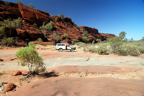
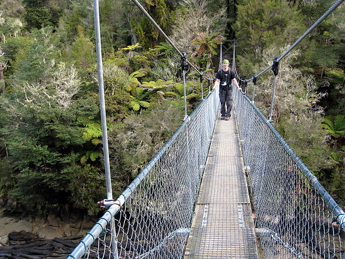
Once in Marahau we checked in for the water taxi and were quickly on our way. The watertaxi is essentially a water-borne bus shuttling hikers to and from the various beaches up the coast in the Abel Tasman National Park as most of the park is inaccessible by roads.


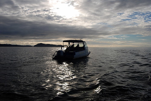
We were going to one of the northern most beach on the taxi route, Totaranui, and so we had about an hour to hour-and-a-half ride. The boat ride turned out to be really fun – much more than just necessary transport. We got to see all the bays and coves along the coast, and the driver took us to a seal colony at a nearby island (with many pups) and into the Awaroa estuary since it was high tide. In the estuary we spotted several large manta rays gliding about – apparently they come into the fresh water to help get rid of parasites. Believe it or not, this large estuary is dry enough to walk across at low tide, and we'd be doing just that on our second day.

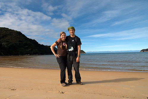
By the time we alighted on beautiful Totaranui beach it was time for lunch, but we settled for peanut-butter and jelly sandwiches – haha. The sandflies were murderous - we ate in a cloud of flies with several fantail birds zipping around and even landing on us to catch them. The fantails are a tramper's best friend :)


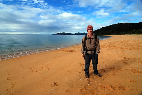
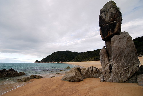
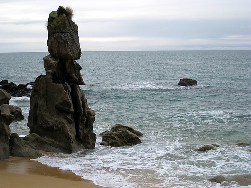
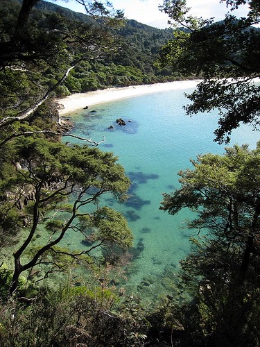
Totaranui beach has a huge campground that is supposedly brimming with hundreds of tourists in the summer – we had it all to ourselves. After lunch we headed north to our destination for the night, Whariwharangi Hut (try saying that three times in a row). The trail took us across the stream at Totaranui beach, then up the headland for some great views. Then back down to secluded Anapai beach with some large stone outcrops that looked like Easter Island heads.


Then up and over another headland to Mutton Cove beach, and since it was by now low tide we could take the tidal route along the beach and up another headland to Separation Point and the seal colony. And finally we headed west and descended to Whariwarangi Bay and the hut during dusk. On the descent we were lucky enough to spot a native NZ owl, the Morepork. Hoot hoot!


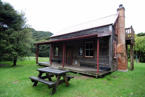
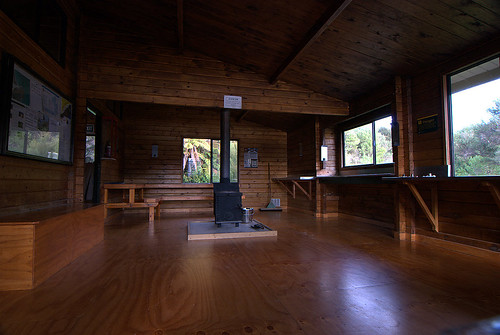
The Whariwarangi hut is a charming historic homestead house that DOC now manages. We foolishly didn't realize we needed to bring candles, but fortunately there were enough candle stubs for us to get by. We had flashlights, but candles are so much better at lighting up the room.


At first we thought we'd have the hut to ourselves, but sometime after dark two german guys showed up. Unlike most of the germans we've met on this trip, they weren't very friendly and just spent the evening talking in german and ignoring us. Oh well – at least they helped us light the cranky wood stove for some heat.


17Jul08
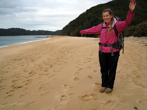
It rained during the night and in the morning, but fortunately stopped before we left the hut. Today we headed south 13km to Akaroa hut and had to hurry to catch the low tide crossing of Akaroa Estuary around 2pm. We started by backtracking to Totaranui beach, partly on the same paths and partly on alternative ones for a change of scenery.


I don't mind backtracking on a trails like this anyways – there is plenty to see and the beaches all look different at high versus low tide. South of Totaranui the trail led us along the beaches of Goat Bay


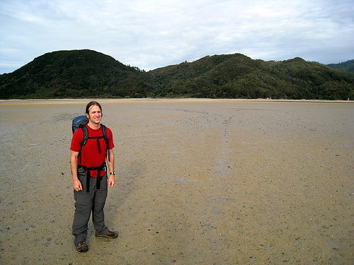
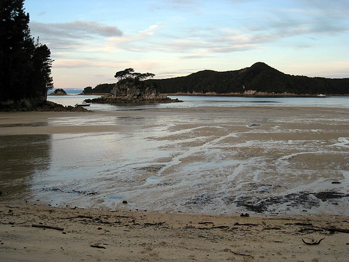
and Waiharakeke Bay, and then inland around a headland to arrive at the northern edge of the large Akaroa estuary. Even though we were running a little behind schedule we were luckily still close enough to low tide to easily cross the tidal flat. The estuary has to be nearly a kilometer across and full of shell fish that crunched under foot. We switched to chacos to spare our boots, but “real jokers” just walk across it with no hesitation!


Akaroa hut is just on the southern edge of the estuary, and so we had an early finish for the day. A group of three guys were at the hut when we arrived, but they decided to press on to the next hut so we lucked out and had the whole place to ourselves. And before they left they gave us some candles :)

Before dark, we walked out towards the ocean to watch the tide come in to the estuary – and it comes in very quickly. There is a little settlement of homes nearby and a tourist lodge.


Akaroa hut is very nice with great views and a central stove that heated up the whole place making for a cosy evening.


18Jul08
Today we hiked 21km south to Anchorage hut. We intentionally got off to a slow start in order to arrive at the Onetahuti tidal crossing at lowish tide. We started by hiking inland for awhile and our hopes of stopping at the lodge cafe for a coffee were dashed by the high tide! Oh well, we didn't *really* need it!

We arrived at Onetahuti stream to find that we didn't need to worry about crossing it as it's fairly small. We stopped for lunch on the beach here and contemplated taking some unguarded kayaks for a spin, but good manners got the better of us and we trudged ahead on foot instead.


Next up was Bark Bay which has an inland “all-tides” track, but since it was low-tide I wanted to take the shorter low-tide beach track... which turned out to be a mistake. We had to wade across a stream that was mid-thigh deep and had a quicksand-like bottom – we sunk up to our ankles – and then across a very mucky estuary plain. So much for the shortcut! Eventually we were back on the main trail headed to Anchorage Hut, but the largest estuary yet was still between us and the hut and we were running out of time due to the slow down at Bark Bay.


When we reached the estuary we were past low-tide, but since the high-tide track took an extra hour and would guarantee us to be hiking past sunset, we decided to push our luck and walk across the estuary hoping not to get flooded by the tide coming back in. This estuary was very large and mucky with lots of little stream rivulets to navigate around, but we made good time and reached the other side before dark and without getting too wet :)


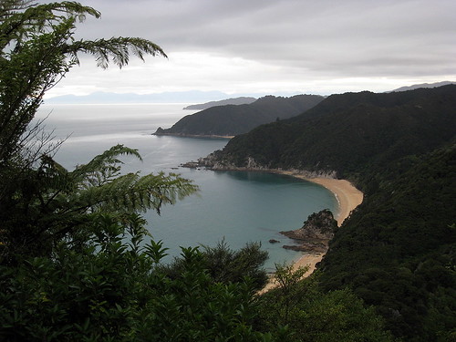
Then it was a quick jaunt up and over a headland to the hut which is located on beautiful Anchorage Bay. Over water-taxi driver told us that around New Year's Eve the bay is bumper to bumper with “boaties” as it's a great holiday spot. It was hard for us to imagine as we walked along the beach watching a fantastic full moon rise.

The hut was nice enough, but unfortunately we had company. A group of six guys had kayaked in with a truckload of booze and food and proceeded to have a loud party (including singing) til late in the night. We were a little irked, to say the least, and jealous of their feast as we nibbled on powdered hummus and stale digestive biscuits! By this the third night we were really running out of food and had to budget ourselves for the next day.

19Jul08
Woke up this morning to a torrential downpour. Ugh, we still had about 10 km back to our van in Marahau. The party-guys were a little more subdued in daylight, although the Trent Reznor lookalike was coughing and hacking so badly I was worried we catch the plague! To be fair, they were nice enough and tempted us to catch the water-taxi home because of the rain, but instead we put on all our raingear and trudged off for the trail figuring it might let up.

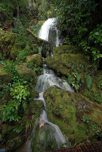
One benefit of the heavy rain is that every little tricky becomes a gushing waterfall. The hike back to Marahau was wet but very pretty and the rain did let up eventually.


By the time we got back to the van we were starving for lunch but all the cafes were closed in Marahau so we had to drive all the way back to Motueka for a big greasy fish and chips, yum :)

Afterwards we headed north to Takaka via spectacular Takaka Hill. We came over the crest and could suddenly see snow-capped mountains and a beautiful green valley below. We checked into a hostel called Annie's Nirvana, which turned out to be kinda down at the heels, but it did have the all important hot showers!

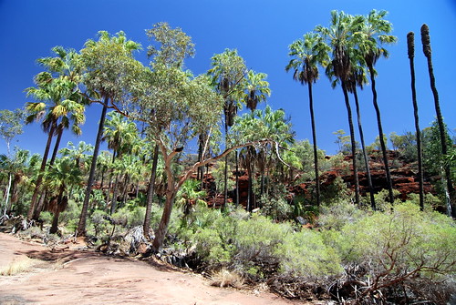
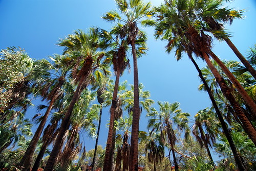
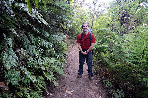
All in all we really enjoyed the Abel Tasman Coastal Track - it was one of the areas we daydreamed about visiting before we started our trip and it was every bit as beautiful as we'd hoped. It's hard to beat palm trees, tree ferns and spectacular beaches.

day 1 photoset
day 2 photoset
day 3-4 photoset