Hi all! Sorry for not posting for so long!
We are currently on the south coast of Australia in Adelaide getting ready to head north into the desert. More on that later :)
Since we're so far behind on the blog I'll probably start posting our current Australia activities as well as continuing to catch up on New Zealand. Hopefully it won't be too confusing. Also I just posted a lengthy (probably too lengthy) account of our last major tramp in NZ. Let us know what you think :)
Cheers,
Christina & Justin

Monday, September 29, 2008
Tramping the Abel Tasman Coastal Track (4 days)
16Jul08
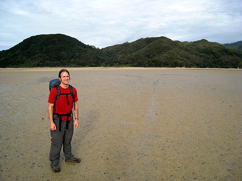
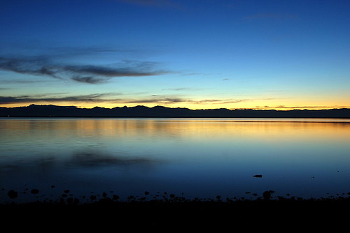
After a short night's sleep we got up very early, raced around the hostel to check out, and headed towards Marahau to catch the watertaxi to our start on the Abel Tasman coastal tramp. The drive to Marahau in the early dawn light turned out to be absolutely stunning – the rosy light reflecting off the still water. We were frustrated that we didn't have time to stop and enjoy it (or photograph it)!
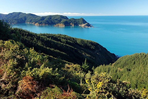
Once in Marahau we checked in for the water taxi and were quickly on our way. The watertaxi is essentially a water-borne bus shuttling hikers to and from the various beaches up the coast in the Abel Tasman National Park as most of the park is inaccessible by roads.
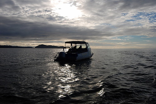
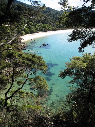
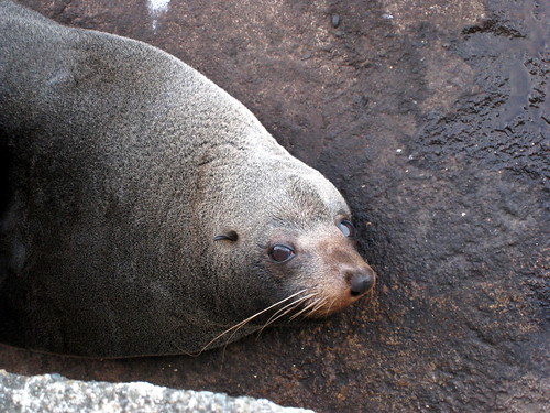
We were going to one of the northern most beach on the taxi route, Totaranui, and so we had about an hour to hour-and-a-half ride. The boat ride turned out to be really fun – much more than just necessary transport. We got to see all the bays and coves along the coast, and the driver took us to a seal colony at a nearby island (with many pups) and into the Awaroa estuary since it was high tide. In the estuary we spotted several large manta rays gliding about – apparently they come into the fresh water to help get rid of parasites. Believe it or not, this large estuary is dry enough to walk across at low tide, and we'd be doing just that on our second day.
By the time we alighted on beautiful Totaranui beach it was time for lunch, but we settled for peanut-butter and jelly sandwiches – haha. The sandflies were murderous - we ate in a cloud of flies with several fantail birds zipping around and even landing on us to catch them. The fantails are a tramper's best friend :)
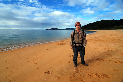
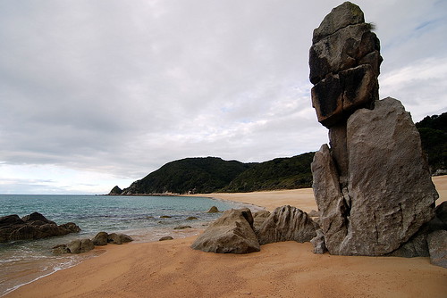
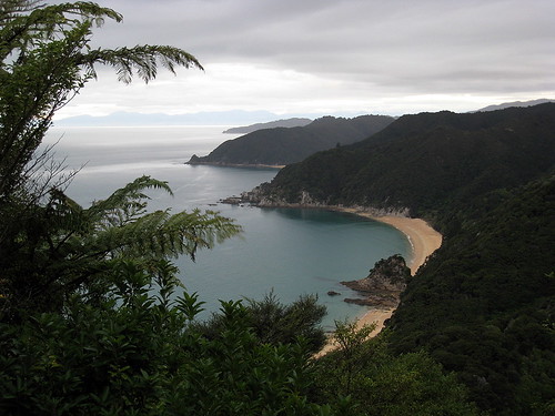
Totaranui beach has a huge campground that is supposedly brimming with hundreds of tourists in the summer – we had it all to ourselves. After lunch we headed north to our destination for the night, Whariwharangi Hut (try saying that three times in a row). The trail took us across the stream at Totaranui beach, then up the headland for some great views. Then back down to secluded Anapai beach with some large stone outcrops that looked like Easter Island heads.
Then up and over another headland to Mutton Cove beach, and since it was by now low tide we could take the tidal route along the beach and up another headland to Separation Point and the seal colony. And finally we headed west and descended to Whariwarangi Bay and the hut during dusk. On the descent we were lucky enough to spot a native NZ owl, the Morepork. Hoot hoot!
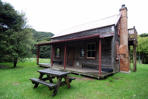
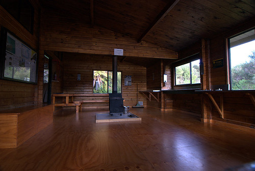
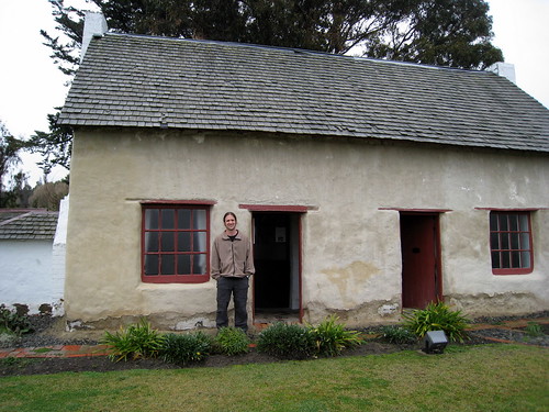
The Whariwarangi hut is a charming historic homestead house that DOC now manages. We foolishly didn't realize we needed to bring candles, but fortunately there were enough candle stubs for us to get by. We had flashlights, but candles are so much better at lighting up the room.
At first we thought we'd have the hut to ourselves, but sometime after dark two german guys showed up. Unlike most of the germans we've met on this trip, they weren't very friendly and just spent the evening talking in german and ignoring us. Oh well – at least they helped us light the cranky wood stove for some heat.
17Jul08
It rained during the night and in the morning, but fortunately stopped before we left the hut. Today we headed south 13km to Akaroa hut and had to hurry to catch the low tide crossing of Akaroa Estuary around 2pm. We started by backtracking to Totaranui beach, partly on the same paths and partly on alternative ones for a change of scenery.
I don't mind backtracking on a trails like this anyways – there is plenty to see and the beaches all look different at high versus low tide. South of Totaranui the trail led us along the beaches of Goat Bay
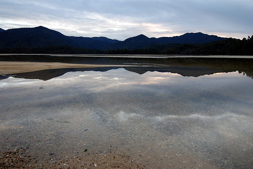
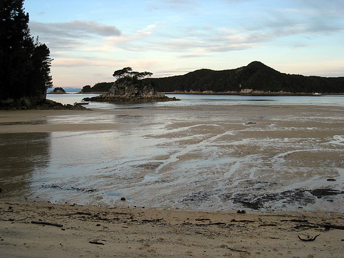
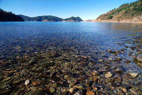
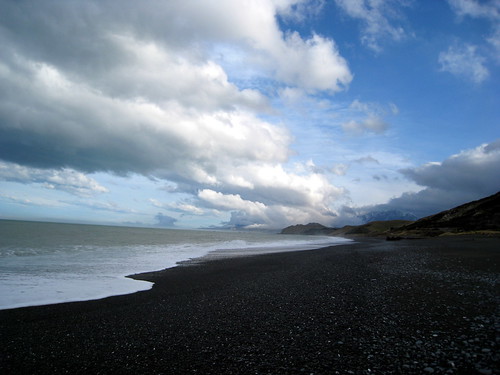
and Waiharakeke Bay, and then inland around a headland to arrive at the northern edge of the large Akaroa estuary. Even though we were running a little behind schedule we were luckily still close enough to low tide to easily cross the tidal flat. The estuary has to be nearly a kilometer across and full of shell fish that crunched under foot. We switched to chacos to spare our boots, but “real jokers” just walk across it with no hesitation!
Akaroa hut is just on the southern edge of the estuary, and so we had an early finish for the day. A group of three guys were at the hut when we arrived, but they decided to press on to the next hut so we lucked out and had the whole place to ourselves. And before they left they gave us some candles :)
Before dark, we walked out towards the ocean to watch the tide come in to the estuary – and it comes in very quickly. There is a little settlement of homes nearby and a tourist lodge.
Akaroa hut is very nice with great views and a central stove that heated up the whole place making for a cosy evening.
18Jul08
Today we hiked 21km south to Anchorage hut. We intentionally got off to a slow start in order to arrive at the Onetahuti tidal crossing at lowish tide. We started by hiking inland for awhile and our hopes of stopping at the lodge cafe for a coffee were dashed by the high tide! Oh well, we didn't *really* need it!
We arrived at Onetahuti stream to find that we didn't need to worry about crossing it as it's fairly small. We stopped for lunch on the beach here and contemplated taking some unguarded kayaks for a spin, but good manners got the better of us and we trudged ahead on foot instead.
Next up was Bark Bay which has an inland “all-tides” track, but since it was low-tide I wanted to take the shorter low-tide beach track... which turned out to be a mistake. We had to wade across a stream that was mid-thigh deep and had a quicksand-like bottom – we sunk up to our ankles – and then across a very mucky estuary plain. So much for the shortcut! Eventually we were back on the main trail headed to Anchorage Hut, but the largest estuary yet was still between us and the hut and we were running out of time due to the slow down at Bark Bay.
When we reached the estuary we were past low-tide, but since the high-tide track took an extra hour and would guarantee us to be hiking past sunset, we decided to push our luck and walk across the estuary hoping not to get flooded by the tide coming back in. This estuary was very large and mucky with lots of little stream rivulets to navigate around, but we made good time and reached the other side before dark and without getting too wet :)
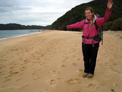
Then it was a quick jaunt up and over a headland to the hut which is located on beautiful Anchorage Bay. Over water-taxi driver told us that around New Year's Eve the bay is bumper to bumper with “boaties” as it's a great holiday spot. It was hard for us to imagine as we walked along the beach watching a fantastic full moon rise.
The hut was nice enough, but unfortunately we had company. A group of six guys had kayaked in with a truckload of booze and food and proceeded to have a loud party (including singing) til late in the night. We were a little irked, to say the least, and jealous of their feast as we nibbled on powdered hummus and stale digestive biscuits! By this the third night we were really running out of food and had to budget ourselves for the next day.
19Jul08
Woke up this morning to a torrential downpour. Ugh, we still had about 10 km back to our van in Marahau. The party-guys were a little more subdued in daylight, although the Trent Reznor lookalike was coughing and hacking so badly I was worried we catch the plague! To be fair, they were nice enough and tempted us to catch the water-taxi home because of the rain, but instead we put on all our raingear and trudged off for the trail figuring it might let up.
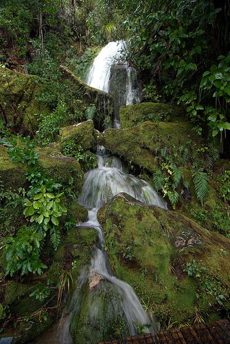
One benefit of the heavy rain is that every little tricky becomes a gushing waterfall. The hike back to Marahau was wet but very pretty and the rain did let up eventually.
By the time we got back to the van we were starving for lunch but all the cafes were closed in Marahau so we had to drive all the way back to Motueka for a big greasy fish and chips, yum :)
Afterwards we headed north to Takaka via spectacular Takaka Hill. We came over the crest and could suddenly see snow-capped mountains and a beautiful green valley below. We checked into a hostel called Annie's Nirvana, which turned out to be kinda down at the heels, but it did have the all important hot showers!
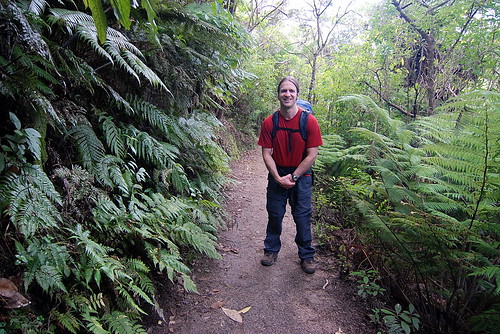
All in all we really enjoyed the Abel Tasman Coastal Track - it was one of the areas we daydreamed about visiting before we started our trip and it was every bit as beautiful as we'd hoped. It's hard to beat palm trees, tree ferns and spectacular beaches.
day 1 photoset
day 2 photoset
day 3-4 photoset
After a short night's sleep we got up very early, raced around the hostel to check out, and headed towards Marahau to catch the watertaxi to our start on the Abel Tasman coastal tramp. The drive to Marahau in the early dawn light turned out to be absolutely stunning – the rosy light reflecting off the still water. We were frustrated that we didn't have time to stop and enjoy it (or photograph it)!
Once in Marahau we checked in for the water taxi and were quickly on our way. The watertaxi is essentially a water-borne bus shuttling hikers to and from the various beaches up the coast in the Abel Tasman National Park as most of the park is inaccessible by roads.
We were going to one of the northern most beach on the taxi route, Totaranui, and so we had about an hour to hour-and-a-half ride. The boat ride turned out to be really fun – much more than just necessary transport. We got to see all the bays and coves along the coast, and the driver took us to a seal colony at a nearby island (with many pups) and into the Awaroa estuary since it was high tide. In the estuary we spotted several large manta rays gliding about – apparently they come into the fresh water to help get rid of parasites. Believe it or not, this large estuary is dry enough to walk across at low tide, and we'd be doing just that on our second day.
By the time we alighted on beautiful Totaranui beach it was time for lunch, but we settled for peanut-butter and jelly sandwiches – haha. The sandflies were murderous - we ate in a cloud of flies with several fantail birds zipping around and even landing on us to catch them. The fantails are a tramper's best friend :)
Totaranui beach has a huge campground that is supposedly brimming with hundreds of tourists in the summer – we had it all to ourselves. After lunch we headed north to our destination for the night, Whariwharangi Hut (try saying that three times in a row). The trail took us across the stream at Totaranui beach, then up the headland for some great views. Then back down to secluded Anapai beach with some large stone outcrops that looked like Easter Island heads.
Then up and over another headland to Mutton Cove beach, and since it was by now low tide we could take the tidal route along the beach and up another headland to Separation Point and the seal colony. And finally we headed west and descended to Whariwarangi Bay and the hut during dusk. On the descent we were lucky enough to spot a native NZ owl, the Morepork. Hoot hoot!
The Whariwarangi hut is a charming historic homestead house that DOC now manages. We foolishly didn't realize we needed to bring candles, but fortunately there were enough candle stubs for us to get by. We had flashlights, but candles are so much better at lighting up the room.
At first we thought we'd have the hut to ourselves, but sometime after dark two german guys showed up. Unlike most of the germans we've met on this trip, they weren't very friendly and just spent the evening talking in german and ignoring us. Oh well – at least they helped us light the cranky wood stove for some heat.
17Jul08
It rained during the night and in the morning, but fortunately stopped before we left the hut. Today we headed south 13km to Akaroa hut and had to hurry to catch the low tide crossing of Akaroa Estuary around 2pm. We started by backtracking to Totaranui beach, partly on the same paths and partly on alternative ones for a change of scenery.
I don't mind backtracking on a trails like this anyways – there is plenty to see and the beaches all look different at high versus low tide. South of Totaranui the trail led us along the beaches of Goat Bay
and Waiharakeke Bay, and then inland around a headland to arrive at the northern edge of the large Akaroa estuary. Even though we were running a little behind schedule we were luckily still close enough to low tide to easily cross the tidal flat. The estuary has to be nearly a kilometer across and full of shell fish that crunched under foot. We switched to chacos to spare our boots, but “real jokers” just walk across it with no hesitation!
Akaroa hut is just on the southern edge of the estuary, and so we had an early finish for the day. A group of three guys were at the hut when we arrived, but they decided to press on to the next hut so we lucked out and had the whole place to ourselves. And before they left they gave us some candles :)
Before dark, we walked out towards the ocean to watch the tide come in to the estuary – and it comes in very quickly. There is a little settlement of homes nearby and a tourist lodge.
Akaroa hut is very nice with great views and a central stove that heated up the whole place making for a cosy evening.
18Jul08
Today we hiked 21km south to Anchorage hut. We intentionally got off to a slow start in order to arrive at the Onetahuti tidal crossing at lowish tide. We started by hiking inland for awhile and our hopes of stopping at the lodge cafe for a coffee were dashed by the high tide! Oh well, we didn't *really* need it!
We arrived at Onetahuti stream to find that we didn't need to worry about crossing it as it's fairly small. We stopped for lunch on the beach here and contemplated taking some unguarded kayaks for a spin, but good manners got the better of us and we trudged ahead on foot instead.
Next up was Bark Bay which has an inland “all-tides” track, but since it was low-tide I wanted to take the shorter low-tide beach track... which turned out to be a mistake. We had to wade across a stream that was mid-thigh deep and had a quicksand-like bottom – we sunk up to our ankles – and then across a very mucky estuary plain. So much for the shortcut! Eventually we were back on the main trail headed to Anchorage Hut, but the largest estuary yet was still between us and the hut and we were running out of time due to the slow down at Bark Bay.
When we reached the estuary we were past low-tide, but since the high-tide track took an extra hour and would guarantee us to be hiking past sunset, we decided to push our luck and walk across the estuary hoping not to get flooded by the tide coming back in. This estuary was very large and mucky with lots of little stream rivulets to navigate around, but we made good time and reached the other side before dark and without getting too wet :)
Then it was a quick jaunt up and over a headland to the hut which is located on beautiful Anchorage Bay. Over water-taxi driver told us that around New Year's Eve the bay is bumper to bumper with “boaties” as it's a great holiday spot. It was hard for us to imagine as we walked along the beach watching a fantastic full moon rise.
The hut was nice enough, but unfortunately we had company. A group of six guys had kayaked in with a truckload of booze and food and proceeded to have a loud party (including singing) til late in the night. We were a little irked, to say the least, and jealous of their feast as we nibbled on powdered hummus and stale digestive biscuits! By this the third night we were really running out of food and had to budget ourselves for the next day.
19Jul08
Woke up this morning to a torrential downpour. Ugh, we still had about 10 km back to our van in Marahau. The party-guys were a little more subdued in daylight, although the Trent Reznor lookalike was coughing and hacking so badly I was worried we catch the plague! To be fair, they were nice enough and tempted us to catch the water-taxi home because of the rain, but instead we put on all our raingear and trudged off for the trail figuring it might let up.
One benefit of the heavy rain is that every little tricky becomes a gushing waterfall. The hike back to Marahau was wet but very pretty and the rain did let up eventually.
By the time we got back to the van we were starving for lunch but all the cafes were closed in Marahau so we had to drive all the way back to Motueka for a big greasy fish and chips, yum :)
Afterwards we headed north to Takaka via spectacular Takaka Hill. We came over the crest and could suddenly see snow-capped mountains and a beautiful green valley below. We checked into a hostel called Annie's Nirvana, which turned out to be kinda down at the heels, but it did have the all important hot showers!
All in all we really enjoyed the Abel Tasman Coastal Track - it was one of the areas we daydreamed about visiting before we started our trip and it was every bit as beautiful as we'd hoped. It's hard to beat palm trees, tree ferns and spectacular beaches.
day 1 photoset
day 2 photoset
day 3-4 photoset
Saturday, August 30, 2008
The Green Monkeys in Queen Charlotte's Cowshed
14Jul08
Cowshed Bay to Nelson
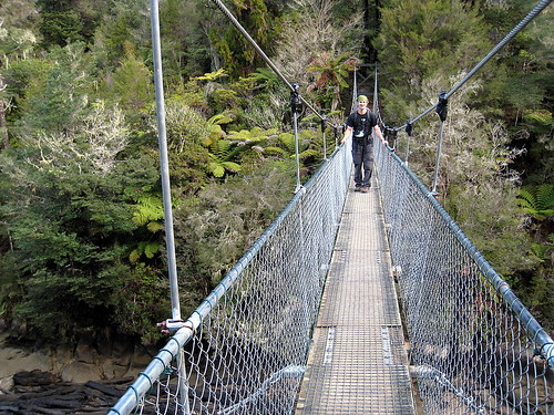
You would think that when camping we would wake up early because of the sunlight and unfamiliar noises, but our curtains block the morning light so well we never seem to get that dawn start I imagined back at the trip's beginning. Today, despite our usual slow start, we're determined to walk at least one leg of the Queen Charlotte track. It's a relatively sunny day, and the track itself is supposed to be quite easy. We drive a short distance from Cowshed Bay to where a road intersects the track, pack lunch, then head up a hill.
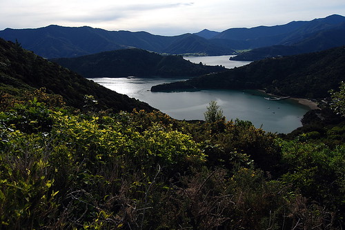
The track wends its way through the usual DOC-land regenerating bush, and the more overgrown spots are quite shady and cool, while others are completely out in the open. Here and there through clearings, we are treated to views across Queen Charlotte and Kenepuru. The waters are still and undisturbed except for the occasional boat.
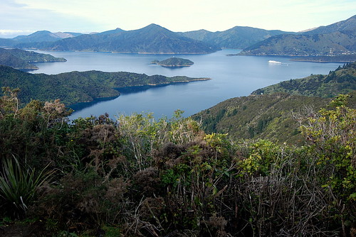
Across the water small houses and sheep dot the hills; the views are all quite pastoral. It's very strange to me to look out at this and think of it as a vision of England filtered through New Zealand. I've never been to England, but the views I see call up memories of pictures of English farms, hedgerows, stone fences, and green, green, rolling hills. We stop to eat lunch at the high spot of this leg of the tramp, and watch the clouds drift by.
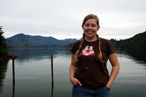
The length of track allocated for this day's walk is much less than we expected. I suppose it's meant as one of the easier tramps. In any case, we get back to our van much earlier than we had expected. With a couple of hours of sun left, we detour down to the Queen Charlotte side of the peninsula and admire a beautiful little cove tucked away between the hills. There's a tiny pier here; its legs are encrusted with shellfish and dotted with starfish. The water is clear and shallow and almost demands that we come back with kayaks. Across the water a tiny boathouse, palm tree, and dock hint at the bach half-hidden up in the bush.
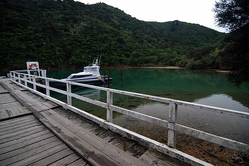
Eventually a strange assemblage of boats smokes into view. By the time it reaches the middle of the cove, we can make out the details, but they only add to the mystery. It's a tiny fishing boat, engine smoking heavily under the load, a smaller launch, and a tiny flat-topped barge, laden with junk. All of these are somehow lashed together and slowly puttering along. Aboard is a salty-looking guy and a dog which jumps back and forth between the 3 boats excitedly.
We leave the cove and drive out the way we came in, then westward to Nelson. There are far more mountains to climb over than I anticipated from staring at a flat road map, but our slow progress is rewarded by coming into Nelson with the last of the fading day. It's chilly, but the lights of Nelson on the hills are welcoming, and the sunset over the mountains and what must be far-away Farewell Spit is stunning.
We check into the Green Monkey, which turns out to be a really nice hostel, then go out for kebabs at a place recommended by the owners. After a few days of camping it's really pleasant to shower and put on some clean clothes.
The hostel itself turns out to be named in honor of the hosts' less-than-pleasant encounter with a group of green monkeys in Africa. I make a mental note to never take a nap someplace where monkeys could pee on me.
One of the other guests at the hostel is a guy named Charlie, who turns out to be a British expat doing mostly contract IT work in Asia. He's well-read, and we spend some time comparing books we are currently reading. He's going through Thomas Paine's "Common Sense", and I'm dredging my way through David Henry Thoreau's "Walden", and we chat on a bit about them. Charlie's just finished an alpine loop through the Nelson Lakes, and he regales us with stories of trudging through snow. He also suggests we take instant hummus powder along with us as an addition to our tramp food, an idea we are excited about because it's something not sweet, not junky, not granola-ey, not gooey, and not sausage-y.
Eventually the long day gets the best of us and we crawl in bed.
15Jul08
Nelson for a day
Though we've just made it into Nelson, we are already planning to leave. The forecast this morning shows a window of decent, 'mostly-dry' weather for the next 3 days, followed by a period of serious rain. Weather forecasts haven't always been the most accurate here, but it's the best we've got, and we know that if we don't do the Abel Tasman Coastal walk now, we may not get another chance.
The Abel Tasman park is home to lots of stunning scenery which I've been dying to see first-hand since I first started researching NZ, so I don't really mind the fast turn-around. We're coming to one of the parts of NZ I am most excited to see.
The easiest way for us to cover most of the Abel Tasman is to take an 'aquataxi' boat up the coast to near the NW end of the track, then walk back SE out of the park and to our van. We go ahead and book a ride for next morning at 9am. People we ask at the hostel opine that it'll take about 45 minutes to get from Nelson to the Aquataxi launch in Marahau.
This done, we venture out to see a bit of Nelson and buy any supplies we need for the trip. Charlie, our acquaintance from last night, walks along with us to the DOC office/I-site, then heads off on his own errands. It's an overcast but mild day. We book the huts for Abel Tasman, check for any warnings or alerts, then head out and around the town.
Nelson is a bustling, lively little town nestled into the hills surounding the south end of the Tasman Bay with an obvious art scene, lots of cafes, many charming old houses, and plenty of sights to rubberneck at for free. We wander around the downtown for a bit, which is nice enough, although the Nelson Central Post Office and clock tower loom over the rest of the buildings like a prison complex. We head up the main street and walk through the landscaped Christ Church Cathedral grounds, then peek at the church's interior before wandering back out in search of coffee.
Eventually we make it to Lambretta coffee house, with a (surprise!) Italian Lambretta motor scooter mounted over the door. It's a nice break from the busy streets; the coffee is great and helps wake us up. We people-watch out the window, wondering why the 80's fashions which are back are the ones which stunk the worst the first time around. I guess that's what geezerdom does to you.
The rest of the day pretty much passes without note, and aside from hitting the grocery store and cooking dinner, we don't do much besides pre-pack our bags for the tramp.
Marlborough Sounds and Nelson photoset
Cowshed Bay to Nelson
You would think that when camping we would wake up early because of the sunlight and unfamiliar noises, but our curtains block the morning light so well we never seem to get that dawn start I imagined back at the trip's beginning. Today, despite our usual slow start, we're determined to walk at least one leg of the Queen Charlotte track. It's a relatively sunny day, and the track itself is supposed to be quite easy. We drive a short distance from Cowshed Bay to where a road intersects the track, pack lunch, then head up a hill.
The track wends its way through the usual DOC-land regenerating bush, and the more overgrown spots are quite shady and cool, while others are completely out in the open. Here and there through clearings, we are treated to views across Queen Charlotte and Kenepuru. The waters are still and undisturbed except for the occasional boat.
Across the water small houses and sheep dot the hills; the views are all quite pastoral. It's very strange to me to look out at this and think of it as a vision of England filtered through New Zealand. I've never been to England, but the views I see call up memories of pictures of English farms, hedgerows, stone fences, and green, green, rolling hills. We stop to eat lunch at the high spot of this leg of the tramp, and watch the clouds drift by.
The length of track allocated for this day's walk is much less than we expected. I suppose it's meant as one of the easier tramps. In any case, we get back to our van much earlier than we had expected. With a couple of hours of sun left, we detour down to the Queen Charlotte side of the peninsula and admire a beautiful little cove tucked away between the hills. There's a tiny pier here; its legs are encrusted with shellfish and dotted with starfish. The water is clear and shallow and almost demands that we come back with kayaks. Across the water a tiny boathouse, palm tree, and dock hint at the bach half-hidden up in the bush.
Eventually a strange assemblage of boats smokes into view. By the time it reaches the middle of the cove, we can make out the details, but they only add to the mystery. It's a tiny fishing boat, engine smoking heavily under the load, a smaller launch, and a tiny flat-topped barge, laden with junk. All of these are somehow lashed together and slowly puttering along. Aboard is a salty-looking guy and a dog which jumps back and forth between the 3 boats excitedly.
We leave the cove and drive out the way we came in, then westward to Nelson. There are far more mountains to climb over than I anticipated from staring at a flat road map, but our slow progress is rewarded by coming into Nelson with the last of the fading day. It's chilly, but the lights of Nelson on the hills are welcoming, and the sunset over the mountains and what must be far-away Farewell Spit is stunning.
We check into the Green Monkey, which turns out to be a really nice hostel, then go out for kebabs at a place recommended by the owners. After a few days of camping it's really pleasant to shower and put on some clean clothes.
The hostel itself turns out to be named in honor of the hosts' less-than-pleasant encounter with a group of green monkeys in Africa. I make a mental note to never take a nap someplace where monkeys could pee on me.
One of the other guests at the hostel is a guy named Charlie, who turns out to be a British expat doing mostly contract IT work in Asia. He's well-read, and we spend some time comparing books we are currently reading. He's going through Thomas Paine's "Common Sense", and I'm dredging my way through David Henry Thoreau's "Walden", and we chat on a bit about them. Charlie's just finished an alpine loop through the Nelson Lakes, and he regales us with stories of trudging through snow. He also suggests we take instant hummus powder along with us as an addition to our tramp food, an idea we are excited about because it's something not sweet, not junky, not granola-ey, not gooey, and not sausage-y.
Eventually the long day gets the best of us and we crawl in bed.
15Jul08
Nelson for a day
Though we've just made it into Nelson, we are already planning to leave. The forecast this morning shows a window of decent, 'mostly-dry' weather for the next 3 days, followed by a period of serious rain. Weather forecasts haven't always been the most accurate here, but it's the best we've got, and we know that if we don't do the Abel Tasman Coastal walk now, we may not get another chance.
The Abel Tasman park is home to lots of stunning scenery which I've been dying to see first-hand since I first started researching NZ, so I don't really mind the fast turn-around. We're coming to one of the parts of NZ I am most excited to see.
The easiest way for us to cover most of the Abel Tasman is to take an 'aquataxi' boat up the coast to near the NW end of the track, then walk back SE out of the park and to our van. We go ahead and book a ride for next morning at 9am. People we ask at the hostel opine that it'll take about 45 minutes to get from Nelson to the Aquataxi launch in Marahau.
This done, we venture out to see a bit of Nelson and buy any supplies we need for the trip. Charlie, our acquaintance from last night, walks along with us to the DOC office/I-site, then heads off on his own errands. It's an overcast but mild day. We book the huts for Abel Tasman, check for any warnings or alerts, then head out and around the town.
Nelson is a bustling, lively little town nestled into the hills surounding the south end of the Tasman Bay with an obvious art scene, lots of cafes, many charming old houses, and plenty of sights to rubberneck at for free. We wander around the downtown for a bit, which is nice enough, although the Nelson Central Post Office and clock tower loom over the rest of the buildings like a prison complex. We head up the main street and walk through the landscaped Christ Church Cathedral grounds, then peek at the church's interior before wandering back out in search of coffee.
Eventually we make it to Lambretta coffee house, with a (surprise!) Italian Lambretta motor scooter mounted over the door. It's a nice break from the busy streets; the coffee is great and helps wake us up. We people-watch out the window, wondering why the 80's fashions which are back are the ones which stunk the worst the first time around. I guess that's what geezerdom does to you.
The rest of the day pretty much passes without note, and aside from hitting the grocery store and cooking dinner, we don't do much besides pre-pack our bags for the tramp.
Marlborough Sounds and Nelson photoset
Unbefouled by Peafowl
13Jul08
Robin Hood Bay to Cowshed Bay
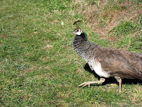
The morning is chilly, but still clear. While our backs are turned during the usual breakfast clean-up, the pea-hen hops into our van. After a few seconds of tense-but-restrained hand-waving, hoping not to stimulate a load-lightening flight response, we chase her back out. Luckily, inspection confirms we acquired nothing worse than a couple of muddy footprints on the floor during her visit. Our van is not quite yet ready to be turned into a poultry house!
North winding along the coast, we drive through skies so blue they almost hurt, stopping periodically to look down and across the sparkling turquoise sea. Each cove, inlet, and bay is its own little world. A few of them have houses; many are unpeopled. The area we are driving through is part of the Marlborough Sound region, and here the land and the sea so intertwine that the coastline seems a perfect example of a real-world fractal as described by Mandelbrot in "The Beauty of Fractals". The land itself is hilly and often steep, rising right out of the water except for tiny half-hidden beaches that can only be reached by boat.
It would all seem idyllic and unspoiled were it not for the fact that aside from a few homes, every slope is either managed pine forest or devastated clear-cut. If you squint your eyes a bit, it's still mostly just green hills against beautiful, almost still waters, but close-up the sterility of the pine plantations is pretty obvious. Aside from the trees, little else grows except a few shrubs and ferns on the roadsides. The number of birds and other wildlife is markedly lower than we've seen elsewhere. I remember looking at pictures on flickr of this area and noting the green, green hills against the sparkling water, but completely failing to remark the fact that the green was plantation and not native.
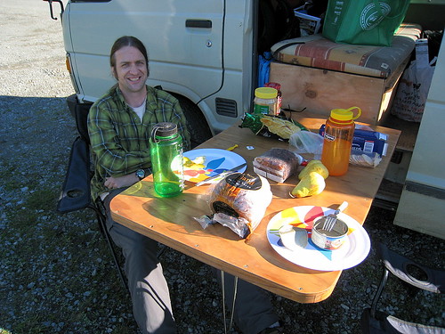
Even so, it's a most spectacular day. We drive through the sunshine and daydream. Towards noon, we drive into one of the few tiny seaside cluster of homes, and stop for lunch on a gravelly spot down beside the water. We pull our van's table out and sit facing the sea. A few local boats bob slowly and the occasional car drifts by.
Eventually we make it through to Picton. We hurry on west out of town and up the peninsula sandwiched between Kenepuru Sound on the North and Queen Charlotte on the South. Out here it's a mix of rural homes - modest farmhouses with enormous boats parked in the front yards - and holiday bachs perched on the edge of the water. Everywhere along the water's edge continues to be gorgeous, and we agree that the area is at least as striking as the bay of islands if not more so. Marlborough seems to have suffered less of the posh development that seems to be turning the bay of islands into a pretty-but-dull rich-person's playground.
Near dark we pull into a DOC campground on Cowshed Bay and park near the water. So buffered here is the sea from the ocean's surging that the waves barely lap the shore. Tonight's avian camp docent is a weka, who motors over to the van, begs shyly, then runs away.
Midway through dinner, a spanish couple show up. They are very friendly and turn out to be on a weekend jaunt up from Christchurch. It's apparently their first couple of days out in a van, and we do our best to help when their gas stove turns out to be fiddly. The guy drives their van with a great deal of energy, and after observing him spinning his tires repeatedly while repositioning the van within their site, we suggest they move to higher, more gravelly ground near us. After so many nights of going to sleep on dry ground and waking up in a bog, we don't want to see them get stuck. Moreover, as they turn out to be leaving at 6am the next morning, we don't really want to have to wake up at 5:30 and help dig them out!
It's another very quiet night. Though we are perhaps only 20 feet from the edge of the water, the sound of the waves against the land is so slight that I have to strain to hear it as I drift off to sleep.
Robin Hood Bay to Cowshed Bay
The morning is chilly, but still clear. While our backs are turned during the usual breakfast clean-up, the pea-hen hops into our van. After a few seconds of tense-but-restrained hand-waving, hoping not to stimulate a load-lightening flight response, we chase her back out. Luckily, inspection confirms we acquired nothing worse than a couple of muddy footprints on the floor during her visit. Our van is not quite yet ready to be turned into a poultry house!
North winding along the coast, we drive through skies so blue they almost hurt, stopping periodically to look down and across the sparkling turquoise sea. Each cove, inlet, and bay is its own little world. A few of them have houses; many are unpeopled. The area we are driving through is part of the Marlborough Sound region, and here the land and the sea so intertwine that the coastline seems a perfect example of a real-world fractal as described by Mandelbrot in "The Beauty of Fractals". The land itself is hilly and often steep, rising right out of the water except for tiny half-hidden beaches that can only be reached by boat.
It would all seem idyllic and unspoiled were it not for the fact that aside from a few homes, every slope is either managed pine forest or devastated clear-cut. If you squint your eyes a bit, it's still mostly just green hills against beautiful, almost still waters, but close-up the sterility of the pine plantations is pretty obvious. Aside from the trees, little else grows except a few shrubs and ferns on the roadsides. The number of birds and other wildlife is markedly lower than we've seen elsewhere. I remember looking at pictures on flickr of this area and noting the green, green hills against the sparkling water, but completely failing to remark the fact that the green was plantation and not native.
Even so, it's a most spectacular day. We drive through the sunshine and daydream. Towards noon, we drive into one of the few tiny seaside cluster of homes, and stop for lunch on a gravelly spot down beside the water. We pull our van's table out and sit facing the sea. A few local boats bob slowly and the occasional car drifts by.
Eventually we make it through to Picton. We hurry on west out of town and up the peninsula sandwiched between Kenepuru Sound on the North and Queen Charlotte on the South. Out here it's a mix of rural homes - modest farmhouses with enormous boats parked in the front yards - and holiday bachs perched on the edge of the water. Everywhere along the water's edge continues to be gorgeous, and we agree that the area is at least as striking as the bay of islands if not more so. Marlborough seems to have suffered less of the posh development that seems to be turning the bay of islands into a pretty-but-dull rich-person's playground.
Near dark we pull into a DOC campground on Cowshed Bay and park near the water. So buffered here is the sea from the ocean's surging that the waves barely lap the shore. Tonight's avian camp docent is a weka, who motors over to the van, begs shyly, then runs away.
Midway through dinner, a spanish couple show up. They are very friendly and turn out to be on a weekend jaunt up from Christchurch. It's apparently their first couple of days out in a van, and we do our best to help when their gas stove turns out to be fiddly. The guy drives their van with a great deal of energy, and after observing him spinning his tires repeatedly while repositioning the van within their site, we suggest they move to higher, more gravelly ground near us. After so many nights of going to sleep on dry ground and waking up in a bog, we don't want to see them get stuck. Moreover, as they turn out to be leaving at 6am the next morning, we don't really want to have to wake up at 5:30 and help dig them out!
It's another very quiet night. Though we are perhaps only 20 feet from the edge of the water, the sound of the waves against the land is so slight that I have to strain to hear it as I drift off to sleep.
Crashing Blinds and Curious Peahens
12Jul08
Kaikoura to Robin Hood Bay
It's an incredibly blustery night in Kaikoura. The whitecaps we saw in the fading evening light were obviously a foreshadowing of the storm to come. There's a window with a broken latch in the bathroom adjacent to our room, and the wind that howls about our hostel sucks it open no matter how I try to jam it closed. The venetian blind on that window then proceeds to smack into the frame with thundering crashes at the rate of around 2-3 a minute. Around 2am I get up and raise the blinds. This lets all the heated air in the house whistle out, but at least it's now possible to sleep.
In the morning we find out that the storm winds reached 140 km/hour. The streets are full of debris, including a large sheet of styrofoam trapped under our van. We eat breakfast, say goodbye to Eva and Stephanie, and head out on the road. It's a beautifully clear day, and we are eager to see new sights.
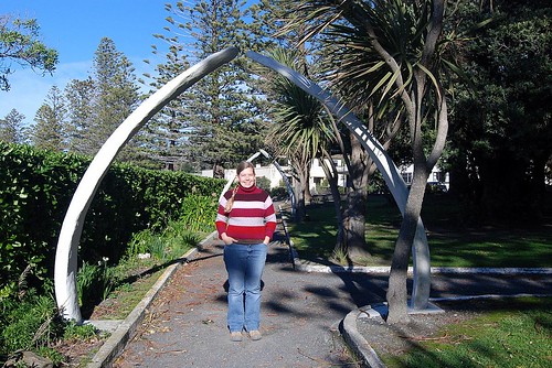
We take a few minutes to see Kaikoura in the daylight. We stop back at the headland we visited last night to see it in the sun, but the parking lot is soon overrun by a 'Kiwi Experience' bus and passengers, so we head back through town, stopping at a small memorial park on the waterfront. The park has a monument to fallen soldiers in WWI, and a walkway lined with arches of weathered whale rib.
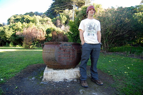
Kaikoura was a local center for whaling in the 19th century, and just across the street are a few 'try pots', giant cauldrons used for the rendering of whale blubber. Now they are simply rusting monuments amidst a few quiet trees.
On the way out of town, we visit a locally-popular pie shop, then drive north back towards Picton.

At Blenheim, we stop for groceries and coffee, then strike out towards the coast on a winding 2-lane road. Through little sea-side developments, then up into the coastal mountains we drive in search of a place to spend the night. As the light begins to really fade, we drive into Robin Hood Bay and decide to stay at the very basic DOC campground. At least there's a long drop! Another couple's also parked for the night, but we never actually meet.
The campground is patrolled by a ravenous peahen. The evidence of its daily route is the fact that the parking area is a minefield of peahen-poo. She loiters about the van most of the evening while we cook dinner, peering inquisitively at our activities and waiting for the inevitable or inadvertent handout.
It's nice to be camping for free, but the local sandflies still demand a payoff. I cook dinner while dancing around to keep the worst of them off, then we eat in the van with the windows closed.
It's a beautiful, quiet, star-filled night.
Kaikoura to Picton photoset
Kaikoura to Robin Hood Bay
It's an incredibly blustery night in Kaikoura. The whitecaps we saw in the fading evening light were obviously a foreshadowing of the storm to come. There's a window with a broken latch in the bathroom adjacent to our room, and the wind that howls about our hostel sucks it open no matter how I try to jam it closed. The venetian blind on that window then proceeds to smack into the frame with thundering crashes at the rate of around 2-3 a minute. Around 2am I get up and raise the blinds. This lets all the heated air in the house whistle out, but at least it's now possible to sleep.
In the morning we find out that the storm winds reached 140 km/hour. The streets are full of debris, including a large sheet of styrofoam trapped under our van. We eat breakfast, say goodbye to Eva and Stephanie, and head out on the road. It's a beautifully clear day, and we are eager to see new sights.
We take a few minutes to see Kaikoura in the daylight. We stop back at the headland we visited last night to see it in the sun, but the parking lot is soon overrun by a 'Kiwi Experience' bus and passengers, so we head back through town, stopping at a small memorial park on the waterfront. The park has a monument to fallen soldiers in WWI, and a walkway lined with arches of weathered whale rib.
Kaikoura was a local center for whaling in the 19th century, and just across the street are a few 'try pots', giant cauldrons used for the rendering of whale blubber. Now they are simply rusting monuments amidst a few quiet trees.
On the way out of town, we visit a locally-popular pie shop, then drive north back towards Picton.
At Blenheim, we stop for groceries and coffee, then strike out towards the coast on a winding 2-lane road. Through little sea-side developments, then up into the coastal mountains we drive in search of a place to spend the night. As the light begins to really fade, we drive into Robin Hood Bay and decide to stay at the very basic DOC campground. At least there's a long drop! Another couple's also parked for the night, but we never actually meet.
The campground is patrolled by a ravenous peahen. The evidence of its daily route is the fact that the parking area is a minefield of peahen-poo. She loiters about the van most of the evening while we cook dinner, peering inquisitively at our activities and waiting for the inevitable or inadvertent handout.
It's nice to be camping for free, but the local sandflies still demand a payoff. I cook dinner while dancing around to keep the worst of them off, then we eat in the van with the windows closed.
It's a beautiful, quiet, star-filled night.
Kaikoura to Picton photoset
Friday, August 29, 2008
Cook Strait, hobo holiday park, and stunning Kaikoura
10Jul08
ferry crossing to Picton
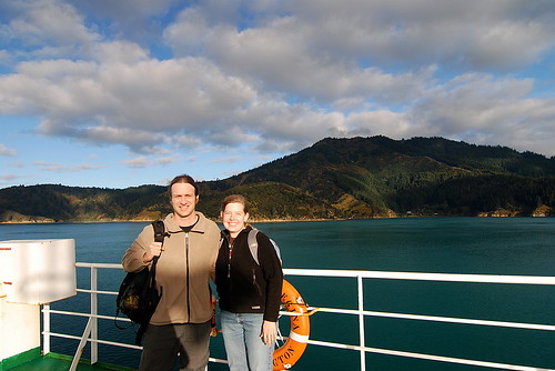
We got up and out early to catch the car ferry across the Cook Strait to Picton in the South Island. Though it's sad for us to say goodbye to the North Island we're really looking forward to the south!
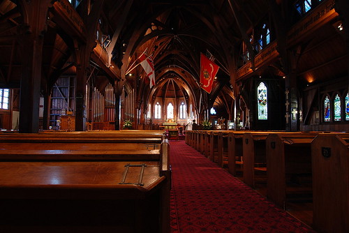
We had a little time to walk around Wellington before the ferry left, so we went inside Old St. Paul's Church - a rare example of timber gothic architecture and a very nice place.
We also walked around the famous NZ government house nicknamed the Beehive. It's very modern and iconic, but not very pretty.
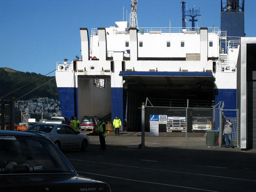
The ferry was quite large – like the one we took to Victoria Island from Vancouver several years ago. The cars all drive into a lower deck – including several semi-trucks, and you aren't allowed to stay below in your car. We thought it was kind of stinky when we boarded, but it wasn't until we disembarked that we noticed a semi of fertilizer was on board!
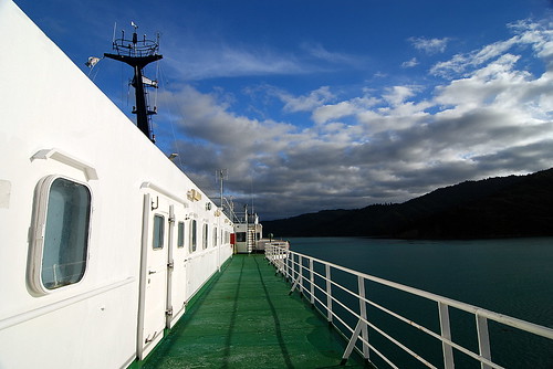
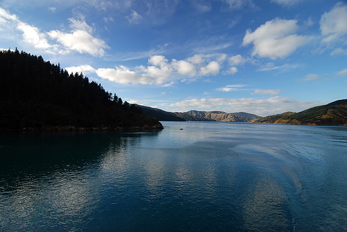
The weather was forecast to be fairly calm – something I consulted when making the booking! So we spent some time up on the top deck watching them ready the boat to leave the dock, and then watching the views as we sailed out of the harbor. The ferry ride lasts about four hours, but you are never far from land and there's great people-watching onboard. The last third of the voyage is sailing up Queen Charlotte Sound and is absolutely spectacular. These sounds are very convoluted and would be great fun to explore on a boat.
Back on dry land in Picton, we stopped at a cafe for a coffee and to decide where to spend the night. We ended up choosing a holiday park that turned out to be fairly run down AND the lousy desk clerk gave us a spot only a couple meters from the freight train track! As the trains rattled by all night it just reminded these two hobos of living near the freight trains in Norman in college. It was also very cold and we were glad to have the heater.
ferry photoset
11Jul08
Picton to Kaikoura
Based on the weather forecast we decided to head south to Kaikoura before looping back to see the Sounds area. We drove through Blenheim which looked like a nice town, and stopped at an historic cob house just outside town that Justin had to investigate for our future homebuilding plans!
After awhile the road begins to closely follow the coast – squeezed between beautiful beaches to the west and steep hills and mountains to the east. We stopped a couple times- for a walk on the beach, and to see a seal colony that had lots of babies/juveniles playing on the rocks.
Then into Kaikoura and around to the headlands to look for more seals and to have a “photo reverie” as the late afternoon light dramatically lit up the ocean.
Haha – it's going to take me years to properly go through all my photos and tweak the RAW files when I get home! But I think I have captured a few gems. As sad as I was to not bring a film camera on this trip it sure has been nice to not worry about buying film and getting it developed and all the additional costs. Of course the downside is that I have so many more “snapshots” to sort through! I've been uploading no more than one-fifth of my photos to flickr. Ah the photographer's burden.
Anyways, that night we checked into a hostel and met a friendly pair of German girls – Eva and Stephanie – who were traveling and gave us lots of recommendations for things to see in Australia. Including a WWOOF farm where you get to feed and take care of orphaned kangaroo babies!! Oh, I can't wait!
Also at the hostel we ran into the two quiet German guys we met at Moana Lodge in Plimmerton. One of them had had his camera stolen the day before (not at this hostel) and was very unhappy. It reminded me to backup my photos! Late that night a huge storm blew through, rattling the house and ruining our sleep.
Kaikoura photoset
ferry crossing to Picton
We got up and out early to catch the car ferry across the Cook Strait to Picton in the South Island. Though it's sad for us to say goodbye to the North Island we're really looking forward to the south!
We had a little time to walk around Wellington before the ferry left, so we went inside Old St. Paul's Church - a rare example of timber gothic architecture and a very nice place.
We also walked around the famous NZ government house nicknamed the Beehive. It's very modern and iconic, but not very pretty.
The ferry was quite large – like the one we took to Victoria Island from Vancouver several years ago. The cars all drive into a lower deck – including several semi-trucks, and you aren't allowed to stay below in your car. We thought it was kind of stinky when we boarded, but it wasn't until we disembarked that we noticed a semi of fertilizer was on board!
The weather was forecast to be fairly calm – something I consulted when making the booking! So we spent some time up on the top deck watching them ready the boat to leave the dock, and then watching the views as we sailed out of the harbor. The ferry ride lasts about four hours, but you are never far from land and there's great people-watching onboard. The last third of the voyage is sailing up Queen Charlotte Sound and is absolutely spectacular. These sounds are very convoluted and would be great fun to explore on a boat.
Back on dry land in Picton, we stopped at a cafe for a coffee and to decide where to spend the night. We ended up choosing a holiday park that turned out to be fairly run down AND the lousy desk clerk gave us a spot only a couple meters from the freight train track! As the trains rattled by all night it just reminded these two hobos of living near the freight trains in Norman in college. It was also very cold and we were glad to have the heater.
ferry photoset
11Jul08
Picton to Kaikoura
Based on the weather forecast we decided to head south to Kaikoura before looping back to see the Sounds area. We drove through Blenheim which looked like a nice town, and stopped at an historic cob house just outside town that Justin had to investigate for our future homebuilding plans!
After awhile the road begins to closely follow the coast – squeezed between beautiful beaches to the west and steep hills and mountains to the east. We stopped a couple times- for a walk on the beach, and to see a seal colony that had lots of babies/juveniles playing on the rocks.
Then into Kaikoura and around to the headlands to look for more seals and to have a “photo reverie” as the late afternoon light dramatically lit up the ocean.
Haha – it's going to take me years to properly go through all my photos and tweak the RAW files when I get home! But I think I have captured a few gems. As sad as I was to not bring a film camera on this trip it sure has been nice to not worry about buying film and getting it developed and all the additional costs. Of course the downside is that I have so many more “snapshots” to sort through! I've been uploading no more than one-fifth of my photos to flickr. Ah the photographer's burden.
Anyways, that night we checked into a hostel and met a friendly pair of German girls – Eva and Stephanie – who were traveling and gave us lots of recommendations for things to see in Australia. Including a WWOOF farm where you get to feed and take care of orphaned kangaroo babies!! Oh, I can't wait!
Also at the hostel we ran into the two quiet German guys we met at Moana Lodge in Plimmerton. One of them had had his camera stolen the day before (not at this hostel) and was very unhappy. It reminded me to backup my photos! Late that night a huge storm blew through, rattling the house and ruining our sleep.
Kaikoura photoset
Wednesday, August 27, 2008
Cable Cars, Sundials, and Temperamental Weather
08Jul08
Wellington
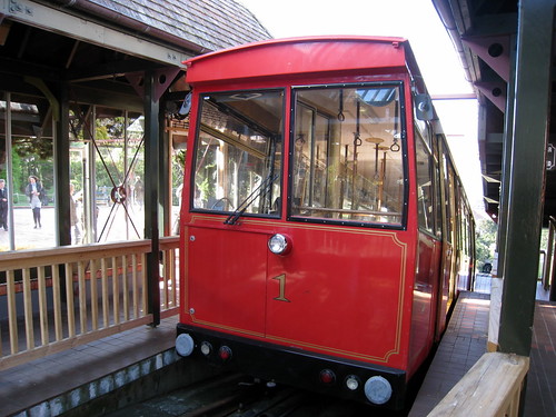
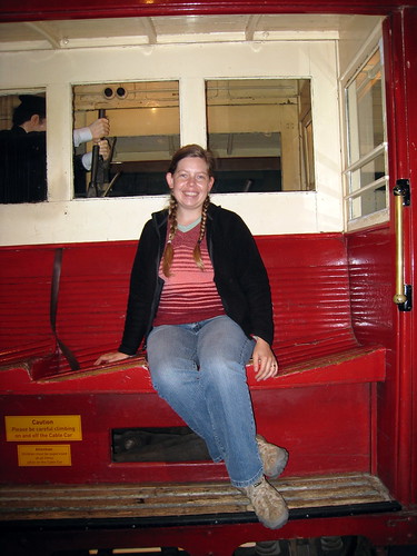
Today we went into Wellington again mainly to see the botanical gardens. We took the historic cable car uphill – sitting across from a friendly woman and her two daughters. At the top we stopped for a coffee and snack at a cafe (carrot cake) and enjoyed the great views of the city and the harbor. We visited the cable car museum - my favorite was the antique cable car that had slanted seats thus creating level seats when on the steep incline.
Then we meandered our way downhill through the large park stopping at several attractions – an old observatory, an Australian desert garden, a human sundial,
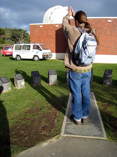
(Justin telling time or praying to the gods of astronomy - you decide!)
a rare NZ plants garden, a section of native forest, a cacti and succulent garden, a “tornado” sculpture, and finally the Victorian hothouse.
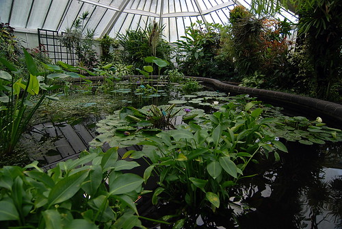
This is a really nice park and since we had fairly good weather it was full of people and kids. Very cheery.
Then we made our way back to downtown, via the government district and drove back to Moana Lodge for the night.
During dinner we talked to a couple girls who were traveling together about things to see in NZ and Southeast Asia. One was from Ireland, and the other from Corpus Christi! Haha... although the Texan girl was trying very hard to affect a kiwi accent and did not seem very happy to talk about our mutual Texas connection. They had a very funny story about zorbing in Rotorua. For those of you not in the know, zorbing is a kiwi-invented adventure sport where you climb inside a huge inflatable ball and get rolled down a hill inside it. To make it more exciting they put some water inside the zorb to splash around with you. Well when the Irish girl was ready for her turn, the supposedly warm water turned out to be freezing cold and she was literally blue when she climbing out of the zorb at the bottom of the hill! Brr!
I must confess, that I really, REALLY wanted to go zorbing while we were here – but we were so turned off by Rotorua that I didn't. Plus it's expensive :(
09Jul08
Plimmerton
On this blustery day we explored the coast north of Plimmerton a little, until we got driven home by the bad weather. For lunch we had tasty fish and chips (or as the Brits say “had a chippie”) at MacLean Street Fish Supply in Paraparaumu. It was takeaway and we ate at a picnic table overlooking the sea (with lots of “friendly” seagulls). Afterwards we headed out to the Queen Elizabeth park on the coast and took a short walk. By then the nice day had turned cold and cloudy so it was back to the hostel to get everything prepared for leaving tomorrow. And by sunset, the clouds had cleared again and we were able to go for one last walk along the beachfront in Plimmerton.
Wellington photoset
Wellington
Today we went into Wellington again mainly to see the botanical gardens. We took the historic cable car uphill – sitting across from a friendly woman and her two daughters. At the top we stopped for a coffee and snack at a cafe (carrot cake) and enjoyed the great views of the city and the harbor. We visited the cable car museum - my favorite was the antique cable car that had slanted seats thus creating level seats when on the steep incline.
Then we meandered our way downhill through the large park stopping at several attractions – an old observatory, an Australian desert garden, a human sundial,
(Justin telling time or praying to the gods of astronomy - you decide!)
a rare NZ plants garden, a section of native forest, a cacti and succulent garden, a “tornado” sculpture, and finally the Victorian hothouse.
This is a really nice park and since we had fairly good weather it was full of people and kids. Very cheery.
Then we made our way back to downtown, via the government district and drove back to Moana Lodge for the night.
During dinner we talked to a couple girls who were traveling together about things to see in NZ and Southeast Asia. One was from Ireland, and the other from Corpus Christi! Haha... although the Texan girl was trying very hard to affect a kiwi accent and did not seem very happy to talk about our mutual Texas connection. They had a very funny story about zorbing in Rotorua. For those of you not in the know, zorbing is a kiwi-invented adventure sport where you climb inside a huge inflatable ball and get rolled down a hill inside it. To make it more exciting they put some water inside the zorb to splash around with you. Well when the Irish girl was ready for her turn, the supposedly warm water turned out to be freezing cold and she was literally blue when she climbing out of the zorb at the bottom of the hill! Brr!
I must confess, that I really, REALLY wanted to go zorbing while we were here – but we were so turned off by Rotorua that I didn't. Plus it's expensive :(
09Jul08
Plimmerton
On this blustery day we explored the coast north of Plimmerton a little, until we got driven home by the bad weather. For lunch we had tasty fish and chips (or as the Brits say “had a chippie”) at MacLean Street Fish Supply in Paraparaumu. It was takeaway and we ate at a picnic table overlooking the sea (with lots of “friendly” seagulls). Afterwards we headed out to the Queen Elizabeth park on the coast and took a short walk. By then the nice day had turned cold and cloudy so it was back to the hostel to get everything prepared for leaving tomorrow. And by sunset, the clouds had cleared again and we were able to go for one last walk along the beachfront in Plimmerton.
Wellington photoset
Subscribe to:
Posts (Atom)